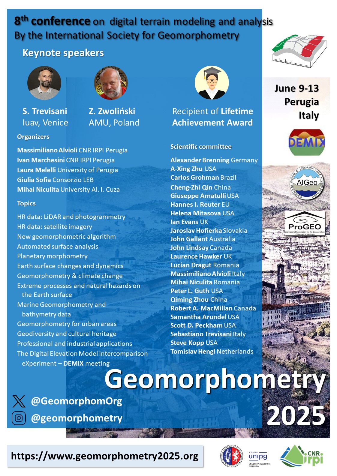
Topics of the conference:
- High resolution data: LiDAR and photogrammetry
- High resolution data: satellite imagery
- New geomorphometric algorithm
- Automated surface analysis
- Planetary morphometry
- Earth surface changes and dynamics
- Geomorphometry & climate change
- Extreme processes and natural hazards on the Earth surface
- Marine Geomorphometry and bathymetry data
- Geomorphometry for urban areas
- Geodiversity and cultural heritage
- Professional and industrial applications
- The Digital Elevation Model Intercomparison eXperiment – DEMIX meeting


